
Region of Bratislava
(Bratislavský kraj · إقليم براتيسلافا · Bratislavský kraj)Region (kraj) of Slovakia
Capital: Bratislava
Cities & Towns
209 places totalRegion of Bratislava covers 2 052 km² divided into 3 municipalities. The regional capital is Bratislava.The region has a population of 1 060 123, with a density of 517 people per km².
179 more places in Region of Bratislava not shown.
Region Maps
SVG and PNG downloads


Municipalities
3 municipalitiesRegion of Bratislava is divided into 3 municipalities. The largest by area is District of Malacky (949 km²) and the smallest is District of Senec (360 km²). District of Senec has the highest building density, with 54 891 buildings.
| Municipality | Population | Area km² | Buildings | Postcodes | |
|---|---|---|---|---|---|
| District of Malacky | 73 857 | 949 | 45 371 | 33 | View |
| District of Pezinok | 61 686 | 375 | 34 650 | 26 | View |
| District of Senec | 64 852 | 360 | 54 891 | 27 | View |
Postcodes
191 postcodesRegion of Bratislava has 191 postcode areas covering 11 492 km² with 984 827 buildings. Region of Bratislava uses the prefixes 9 / 8 - postcodes in Region of Bratislava start with 9xxx, 8xxx (these zones). The postcode with the most buildings is 90301 (Senec) (7 843 buildings).
| # | Code / Name | Population | Area | Buildings | |
|---|---|---|---|---|---|
| 1 | 90201 | 203 818 | 77.99 km² | 4 956 | View → |
| 2 | 85110 | 156 849 | 62.06 km² | 3 581 | View → |
| 3 | 84107 | 94 184 | 23.74 km² | 2 063 | View → |
| 4 | 82107 | 55 453 | 41.7 km² | 4 312 | View → |
| 5 | 82106 | 36 030 | 22.46 km² | 3 493 | View → |
| 6 | 83101 | 29 147 | 21.48 km² | 2 628 | View → |
| 7 | 90301 | 20 698 | 71.39 km² | 7 843 | View → |
| 8 | 90101 | 17 887 | 303.38 km² | 4 507 | View → |
| 9 | 83107 | 10 233 | 9.66 km² | 1 923 | View → |
| 10 | 90042 | 10 198 | 37.13 km² | 6 648 | View → |
Region of Bratislava has 9375 postal facilities 653 Post Offices, 2138 Post Boxes, 6584 Parcel Lockers.
Transport
60 lines across 158 routesClick a route on the map to see details. Zoom in to explore individual stops.
Region of Bratislava has a public transport network of 2560.1 km with 60 transit lines and 158 routes. It is served by 6 operators.
Full transport overviewPopulation & Building Density
By municipality| # | Municipality | Population | Pop/km² | Buildings | Bld/km² | Area km² |
|---|---|---|---|---|---|---|
| 1 | Píla | 338 | 702 /km² | 323 | 671 /km² | 0.481 km² |
| 2 | Malacky | 17 887 | 665 /km² | 7 036 | 261 /km² | 26.8962 km² |
| 3 | Miloslavov | 6 548 | 642 /km² | 4 215 | 413 /km² | 10.1869 km² |
| 4 | Slovenský Grob | 5 136 | 505 /km² | 2 932 | 288 /km² | 10.1669 km² |
| 5 | Senec | 15 750 | 407 /km² | 7 845 | 202 /km² | 38.6695 km² |
| 6 | Ivanka pri Dunaji | 5 777 | 405 /km² | 3 700 | 259 /km² | 14.2538 km² |
| 7 | Marianka | 1 191 | 369 /km² | 1 518 | 470 /km² | 3.2252 km² |
| 8 | Pezinok | 21 656 | 297 /km² | 9 597 | 131 /km² | 72.8379 km² |
| 9 | Zálesie | 1 285 | 219 /km² | 1 237 | 211 /km² | 5.8575 km² |
| 10 | Veľký Biel | 2 219 | 218 /km² | 1 771 | 174 /km² | 10.1591 km² |
| 11 | Vinosady | 1 125 | 218 /km² | 1 001 | 194 /km² | 5.1525 km² |
| 12 | Šenkvice | 5 095 | 205 /km² | 2 654 | 107 /km² | 24.782 km² |
| 13 | Studienka | 3 266 | 194 /km² | 1 512 | 90 /km² | 16.7889 km² |
| 14 | Viničné | 1 795 | 186 /km² | 1 438 | 149 /km² | 9.6153 km² |
| 15 | Rovinka | 1 631 | 184 /km² | 4 212 | 475 /km² | 8.8509 km² |
| 16 | Nová Dedinka | 1 869 | 182 /km² | 1 628 | 159 /km² | 10.239 km² |
| 17 | Bernolákovo | 5 149 | 181 /km² | 5 200 | 183 /km² | 28.4205 km² |
| 18 | Tureň | 944 | 178 /km² | 665 | 125 /km² | 5.2989 km² |
| 19 | Modra | 8 804 | 177 /km² | 5 141 | 103 /km² | 49.6386 km² |
| 20 | Báhoň | 1 856 | 175 /km² | 778 | 73 /km² | 10.5683 km² |
| 21 | Reca | 1 714 | 172 /km² | 892 | 89 /km² | 9.9193 km² |
| 22 | Malinovo | 1 498 | 172 /km² | 2 185 | 251 /km² | 8.703 km² |
| 23 | Chorvátsky Grob | 2 448 | 162 /km² | 3 879 | 256 /km² | 15.1137 km² |
| 24 | Zohor | 3 297 | 156 /km² | 1 936 | 91 /km² | 21.1214 km² |
| 25 | Dunajská Lužná | 3 650 | 135 /km² | 3 661 | 135 /km² | 26.948 km² |
| 26 | Veľké Leváre | 3 575 | 135 /km² | 2 008 | 76 /km² | 26.4284 km² |
| 27 | Stupava | 8 745 | 129 /km² | 6 825 | 101 /km² | 67.4443 km² |
| 28 | Rohožník | 3 534 | 128 /km² | 2 164 | 78 /km² | 27.4444 km² |
| 29 | Záhorská Ves | 1 679 | 128 /km² | 931 | 71 /km² | 13.0352 km² |
| 30 | Kaplna | 700 | 126 /km² | 573 | 103 /km² | 5.5294 km² |
| 31 | Svätý Jur | 4 972 | 124 /km² | 2 733 | 68 /km² | 39.8305 km² |
| 32 | Vysoká pri Morave | 4 000 | 119 /km² | 1 236 | 36 /km² | 33.5846 km² |
| 33 | Vlky | 429 | 118 /km² | 458 | 126 /km² | 3.6204 km² |
| 34 | Jablonec | 1 022 | 117 /km² | 536 | 61 /km² | 8.6852 km² |
| 35 | Hamuliakovo | 1 268 | 115 /km² | 1 669 | 152 /km² | 10.9467 km² |
| 36 | Gajary | 5 788 | 113 /km² | 1 832 | 36 /km² | 50.8139 km² |
| 37 | Tomášov | 2 271 | 113 /km² | 1 818 | 91 /km² | 19.9562 km² |
| 38 | Hrubý Šúr | 672 | 108 /km² | 691 | 111 /km² | 6.2042 km² |
| 39 | Závod | 2 708 | 98 /km² | 2 056 | 75 /km² | 27.3717 km² |
| 40 | Plavecký Štvrtok | 2 362 | 97 /km² | 1 656 | 68 /km² | 24.1609 km² |
| 41 | Limbach | 1 495 | 97 /km² | 1 304 | 85 /km² | 15.2974 km² |
| 42 | Blatné | 1 571 | 96 /km² | 846 | 51 /km² | 16.3161 km² |
| 43 | Boldog | 431 | 95 /km² | 416 | 92 /km² | 4.4932 km² |
| 44 | Most pri Bratislave | 1 690 | 88 /km² | 2 412 | 126 /km² | 19.0282 km² |
| 45 | Jablonové | 1 112 | 84 /km² | 1 252 | 95 /km² | 13.1846 km² |
| 46 | Kalinkovo | 1 068 | 82 /km² | 810 | 62 /km² | 12.908 km² |
| 47 | Budmerice | 2 406 | 80 /km² | 1 687 | 56 /km² | 30.0681 km² |
| 48 | Čataj | 1 003 | 78 /km² | 579 | 45 /km² | 12.8635 km² |
| 49 | Kráľová pri Senci | 1 486 | 74 /km² | 1 251 | 62 /km² | 19.9039 km² |
| 50 | Hrubá Borša | 417 | 71 /km² | 992 | 169 /km² | 5.8485 km² |
| 51 | Jakubov | 1 466 | 70 /km² | 1 037 | 49 /km² | 20.8471 km² |
| 52 | Vištuk | 1 357 | 67 /km² | 820 | 40 /km² | 20.0437 km² |
| 53 | Kostolište | 1 132 | 67 /km² | 1 267 | 75 /km² | 16.8162 km² |
| 54 | Igram | 550 | 66 /km² | 296 | 35 /km² | 8.3039 km² |
| 55 | Dubová | 904 | 65 /km² | 606 | 44 /km² | 13.7765 km² |
| 56 | Častá | 2 305 | 65 /km² | 1 857 | 52 /km² | 35.2384 km² |
| 57 | Lozorno | 2 901 | 64 /km² | 2 316 | 51 /km² | 44.8136 km² |
| 58 | Kostolná pri Dunaji | 495 | 61 /km² | 506 | 62 /km² | 8.065 km² |
| 59 | Štefanová | 354 | 52 /km² | 254 | 37 /km² | 6.716 km² |
| 60 | Malé Leváre | 1 129 | 52 /km² | 1 243 | 58 /km² | 21.4097 km² |
| 61 | Láb | 1 401 | 50 /km² | 1 363 | 49 /km² | 27.8329 km² |
| 62 | Hurbanova Ves | 260 | 48 /km² | 404 | 74 /km² | 5.4126 km² |
| 63 | Doľany | 1 066 | 47 /km² | 989 | 43 /km² | 22.5369 km² |
| 64 | Sološnica | 1 544 | 40 /km² | 1 021 | 27 /km² | 37.754 km² |
| 65 | Suchohrad | 619 | 40 /km² | 457 | 29 /km² | 15.4056 km² |
| 66 | Kuchyňa | 1 691 | 37 /km² | 1 397 | 31 /km² | 45.0983 km² |
| 67 | Borinka | 557 | 35 /km² | 886 | 56 /km² | 15.7676 km² |
| 68 | Plavecké Podhradie | 735 | 34 /km² | 640 | 30 /km² | 21.147 km² |
| 69 | Pernek | 824 | 30 /km² | 776 | 28 /km² | 27.3221 km² |
| 70 | Plavecký Mikuláš | 714 | 26 /km² | 725 | 27 /km² | 26.7149 km² |
| 71 | Nový Svet | 59 | 7 /km² | 80 | 10 /km² | 7.7393 km² |
| 72 | Záhorie (vojenský obvod) | 418 | 1 /km² | 281 | 1 /km² | 276.4796 km² |
Symbols
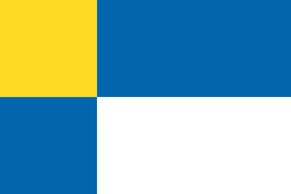
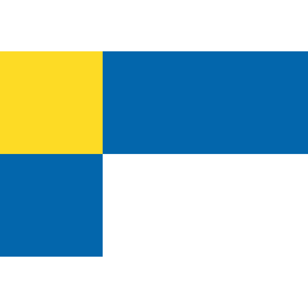
Official symbolsThe official symbols of Region of Bratislava include the coat of arms and flag, both of which appear on government documents and are recognised across Slovakia.
Region Rankings
Compared to all 8 regionsRegion of Bratislava ranks 1th by population (of 8), 8th by area (of 8), 1th by population density (of 8) among the regions of Slovakia.
Neighbouring Regions
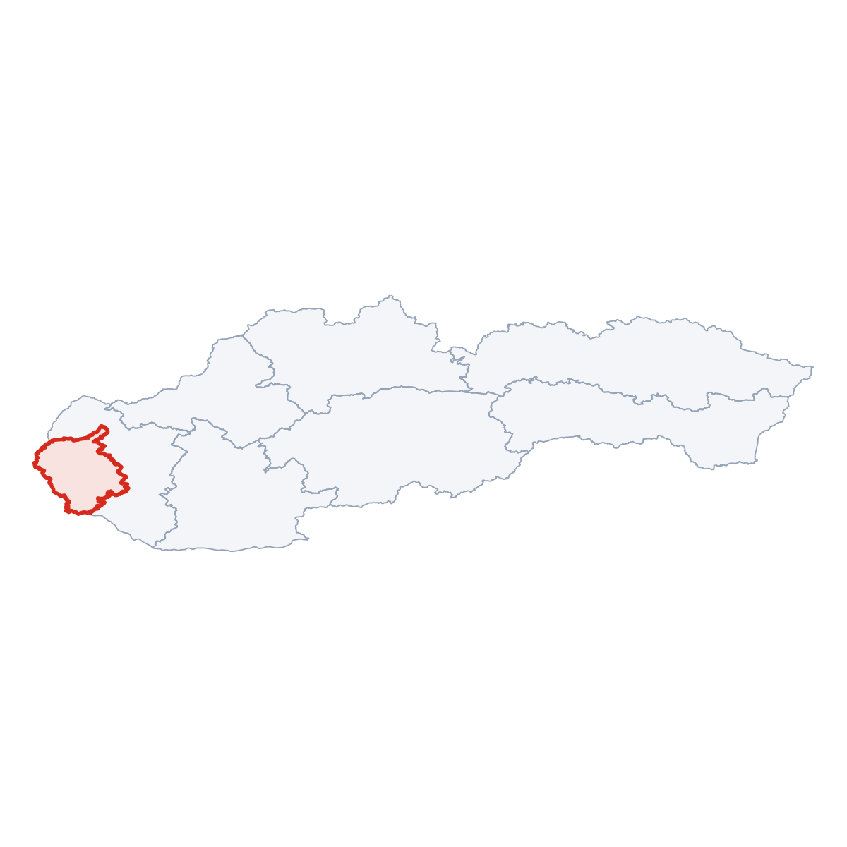
1 bordering regionsRegion of Bratislava borders 1 region: Trnavský kraj (east).




Frequently Asked Questions about Region of Bratislava
Quick answers about this regionWhat is the capital of Region of Bratislava?
The regional capital of Region of Bratislava is Bratislava with a population of 432 801.
How many people live in Region of Bratislava?
Region of Bratislava has a population of 1 060 123, spread across 2 052 km².
How large is Region of Bratislava?
Region of Bratislava covers an area of 2 052 km² (792 sq mi).
Is Region of Bratislava a region or a city?
Region of Bratislava is one of the 8 regions (kraje) of Slovakia, covering a defined administrative area. Its regional capital is Bratislava.
Does Region of Bratislava have municipalities?
Region of Bratislava is divided into 3 municipalities. These include District of Malacky, District of Pezinok, District of Senec
What postcodes are in Region of Bratislava?
Region of Bratislava has 191 postcode areas. Postcodes in Region of Bratislava use the prefix 9, 8.